
Head of South African Weather Service’s risk management department Rudzani Malala and weather forecaster Lehlohonolo Thobela addressed the media regarding the impending cold front set to impact the Western Cape and Northern Cape from Wednesday to Friday.
Image: Oupa Mokoena/ Independent Newspapers
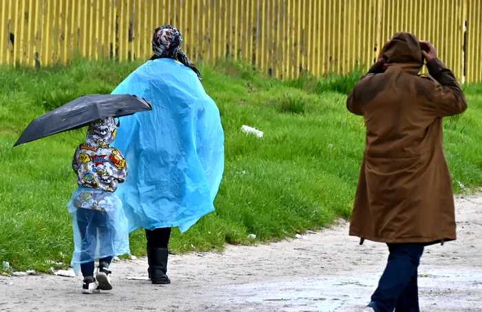
Residents of the Western Cape and Northern Cape are urged to brace themselves for a severe cold front, with heavy rainfall, strong winds, and potential snowfall expected from Wednesday to Friday.
South African Weather Service (SAWS) senior manager Rudzani Malala issued a stark warning of an impending intense cold front set to hit south-western parts of South Africa during a media briefing in Pretoria on Monday.
According to him, the severe winter weather conditions are expected to bring drastic changes to the region, affecting the Namakwa District in the Northern Cape and the Western Cape from Wednesday to Friday.
Malala said the intense cold front is set to make landfall on Wednesday, bringing heavy rainfall to the western parts of the Western Cape, which may lead to localised flooding, particularly in low-lying and poorly drained areas.
He warned that wet and slippery roads could lead to hazardous driving conditions, advising motorists to exercise caution and follow safety measures.
He predicted that strong, gusty winds over the interior may cause localised damage to structures and uproot trees.
Intense cold front is expected to affect the Western and Northern Cape provinces from Wednesday until Friday.
Image: Ayanda Ndamane/ Independent Media
He also forecast cold to very cold conditions, with possible snowfall over the Western Cape's western mountain ranges, potentially spreading to the south-western interior of the Northern Cape.
He further said that gale-force winds and very rough seas, with wave heights of 5.5 to 7.5 metres, are expected to affect the coastlines of the Northern Cape and Western Cape.
This, Malala said, will likely disrupt fishing and port operations, increase the risk of vessel capsizing and accidents at sea, and create hazardous shoreline conditions.
“Coastal residents and beachgoers are urged to exercise caution,” Malala said.
As the system moves eastward, he said, the Eastern Cape will be impacted, a region already susceptible to weather-related effects.
“The key concern is the strong damaging winds expected across most parts of the province on Thursday, 26 June 2025. Interior winds are expected to pick up and spread over the remainder of eastern provinces on Thursday and Friday, 26 and 27 June 2025, with daytime temperatures dropping to the cold category,” he said.
In Gauteng, residents can expect a temperature drop on Friday, with cold conditions persisting on Saturday and a return to winter conditions from Sunday.
Lehlohonolo Thobela, meteorologist and weather forecaster at SAWS, said: “It is just a drop in temperature. We don't have rainfall that is expected with the system.”
He warned that the expected windy conditions could increase the risk of runaway fires.
SAWS will closely monitor the weather systems and provide updates as necessary. For the latest information, follow SAWS on X (@SAWeatherService), Facebook (South African Weather Service), or other supported social media platforms.
rapula.moatshe@inl.co.za