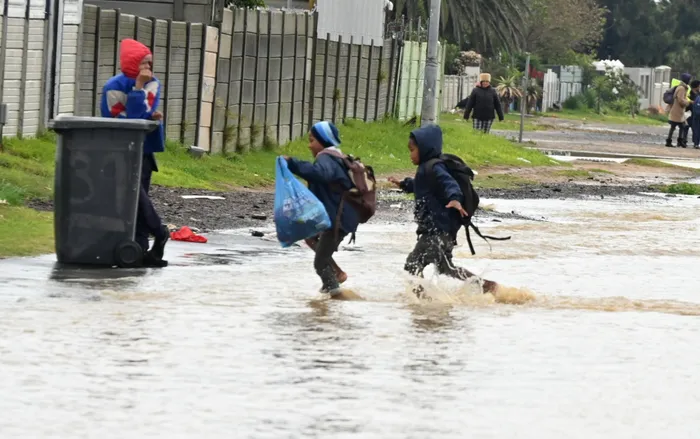
Pupils navigate through a flooded road on the corner of Broadway Boulevard and Broadlands Road in Somerset West. The South African Weather Service said the cold front passed over the Western Cape on Saturday, but that there will still be icy temperatures expected throughout the week.
Image: Independent Newspapers Archive
Residents in the Western Cape may have seen the worst of the cold front pass, but they will still face frosty temperatures as the chill lingers. Meanwhile, other regions across the country continue to feel the effects of this cold front.
This weekend, Cape residents experienced the full force of winter weather, with the cold front bringing persistent rain and freezing temperatures.
The City of Cape Town’s Disaster Risk Management spokesperson, Charlotte Powell, said that they were monitoring for any impacts from the current forecast, but “thus far, no significant impacts have been reported to the Disaster Operations Centre, although this situation might change as the day progresses”.
Residents were urged to direct any requests for City services via the online platforms or the Customer call centre on 0860 103 089, while emergency incidents should be directed to the Public Emergency Communication Centre on 021 480 7700.
SA Weather Services (SAWS) Senior Forecaster Kate Turner said that the cold front passed over the province on Saturday, but that there will still be icy temperatures expected throughout the week.
“A cut off low pressure (system) develops over the central parts of the country tomorrow (Monday), which is causing rain and showers over the central, eastern and southern parts of the country, but significant and heavy rainfall is expected over the Eastern Cape for Monday and Tuesday.
“Significant snowfalls are also expected over the northern parts of the Eastern Cape and extreme southern parts of the Free State,” Turner said.
On social media, the SAWS account explained that by Monday, 9 June 2025 and Tuesday, 10 June 2025, a significant and dramatic drop in daytime temperatures can be expected over all provinces, with the possible exception of Limpopo, due to this extensive and severe winter weather system.
“Consequently, farmers of small stock are strongly advised to implement appropriate measures to prevent stock losses due to exposure to bitter cold and wind.”
As for the outlook for the Western Cape this week, Turner said that cold daytime temperatures are still expected for Monday and Tuesday, “gradually increasing towards the end of the week”.
“Very cold minimum temperatures can be expected for the week. Widespread frost is likely over the interior from Wednesday to Saturday.”
Turner urged that the public dress warmly and avoid outdoor activities to best prepare for the weather.
“Be aware of possible closure of roads, icy road conditions and increase your following driving distances. Make contact with your closest disaster manager or community leader and keep listening to the radio for updates.”
Cape Argus
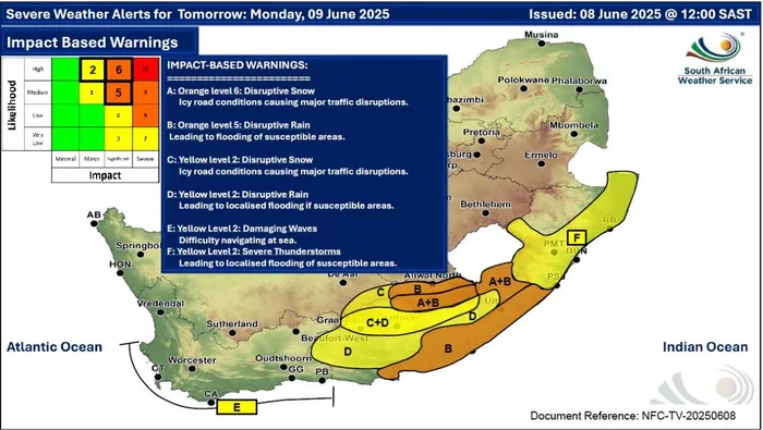
Summary of weather warnings provided by the SA Weather Service.
Image: SAWS/Supplied